
Laguna Sirven Project
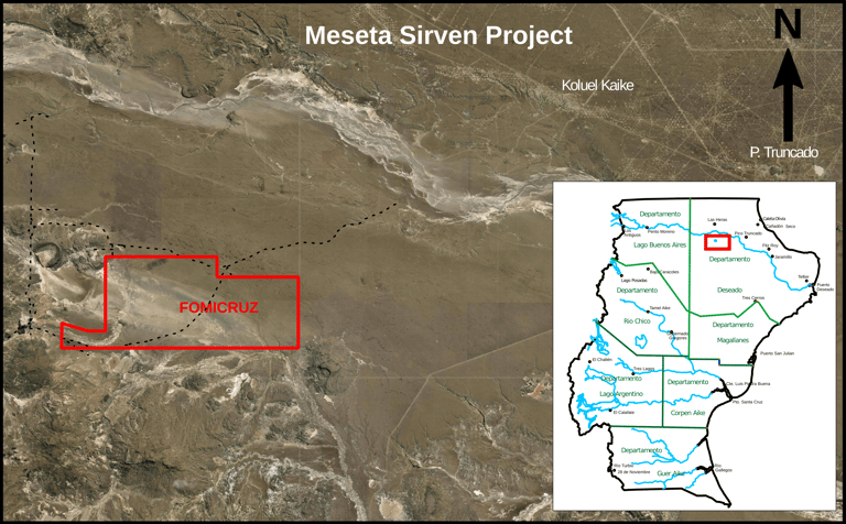
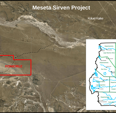
The Meseta Sirven project is located in the north of the Deseado Massif (Fig. 1); it covers an area of 16294 ha, and it is secured by seven mining concessions owned by Fomicruz. Since 2005, Fomicruz has intermittently explored this project for uranium in association with CNEA (the National Atomic Energy Commission of Argentina).
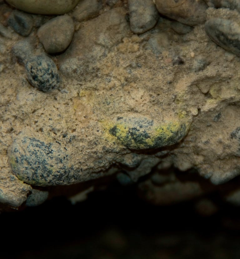
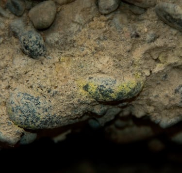
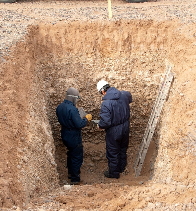
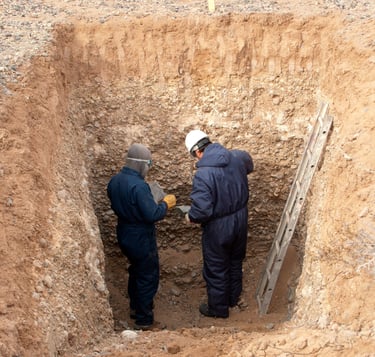
In this project, a layer of young sediments located at shallow depths (commonly at around 1 m depth), is mineralized with uranium (Fig. 2a). That layer of sands and gravels with some carbonates (caliche) and gypsum, forms a low-grade uranium deposit. The project was explored at surface by radimetric surveys, and at depth by geochemical sampling of the sediments, collected from pits opened with a backhoe (Fig. 2b).
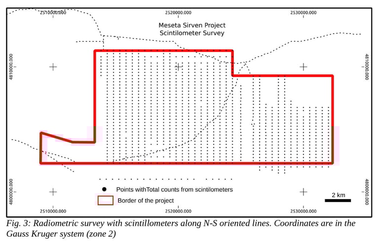
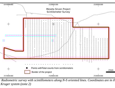
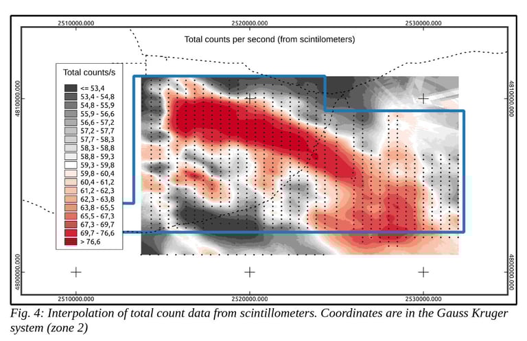
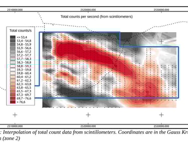
A systematic radiometric ground-based survey was carried out with scintillometers; more than 1000 readings of total counts per second, provided by the scintillometers, were recorded (Fig. 3). Those data were collected at points separated about 250 m from each other, along north-south oriented lines, which were separated by 500 m from each other. The result of this survey was the definition of a northwest-southeast trending anomaly (Fig. 4) that was later studied in subsurface.
Fig. 2: (a) Layer of sediments mineralized with uranium. (b) Example of a pit digged with a backhoe; samples for geochemistry were extracted from the walls.
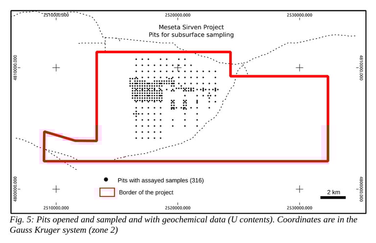
Up to know, we have records of 316 of those pits, including a general description of the mineralized sediments and their contents of uranium, obtained in laboratory.
In addition, we have collected more than 100000 points with topographic data covering about 50% of the area occupied by the project, including the area that was studied in subsurface, with pits.
The geological and geochemical data that we have collected from the pits indicate that the mineralized layer of sediments is located at depth from 0.1 to 1.9 m, but usually at less than 1 m. The thickness of that layer is often near 1 m, and the concentrations of U commonly vary between 70 and 200 g/t; although the maximum concentration obtained was of 5400 g/t U. With the current data we count with, it was estimated that the mineralized sediments with more than 70 g/t U, cover an area of approximately 2500 ha in plan view.
However for a correct evaluation of the project's economic potential as a source of uranium, still more data should be obtained, mainly from the subsurface of areas that show radiometric anomalies at surface.
The most relevant task executed during the exploration was the opening of several pits and sampling the sediments in them. The pits (Fig. 5) were located at the nodes of a grid, which started with an opening of 500 x 500 m and then shifted to an opening of 200 x 200 m. Those pits have approximately 2 x 2 m in plan view, and a depth ranging from two to four meters; they were devised for describing and sampling the mineralized layer of sediments, and later try to estimate the amount of uranium contained and extractable from the deposit.