Argenta Project
The Argenta project is located in the southwest of the Deseado Massif, adjacent to the Martha silver mine, and in the Cerro Primero de Abril metallogenic district (Fig. 1). The project contains several sets of epithermal quartz veins, with a summed total length of 11 km. Some of the veins also contain adularia.
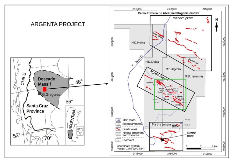
Fig. 1: Location of the Argenta project, showing the locations of quartz veins, some diamond boreholes and the mineral properties owned by Fomicruz
The area of the project is secured by four mining properties covering almost 11,000 hectares. Most of the project had already been explored by other companies before Fomicruz S.E. reclaimed the mining rights in 2015.
Initially, Fomicruz evaluated exploration targets by combining and interpreting its own data, as well as data collected by the previous holders of the mining rights; that included geological, geophysical and geochemical data. In 2016, the Company carried out more exploratory work that included geological mapping, rock chip sampling and the completion of 2262 m of diamond drilling, in 16 boreholes, which were drilled in 6 sectors of the project.
The drilling demonstrated that the veins are continuous up to a vertical depth of at least 201 m, and that their thickness are similar to those at ground surface. At the same time, topography and surface geology were surveyed in the sectors where the drilling was done. Assays from several boreholes returned
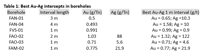
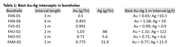
Fig. 1: Location of the Argenta project, showing the locations of quartz veins, some diamond boreholes and the mineral properties owned by Fomicruzanomalous concentrations of Au and Ag from the veins; some of those geochemical data are shown in Table 1.
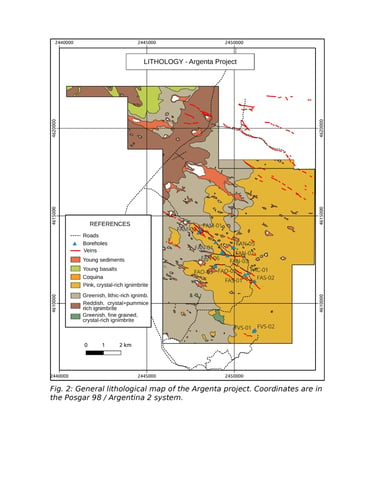
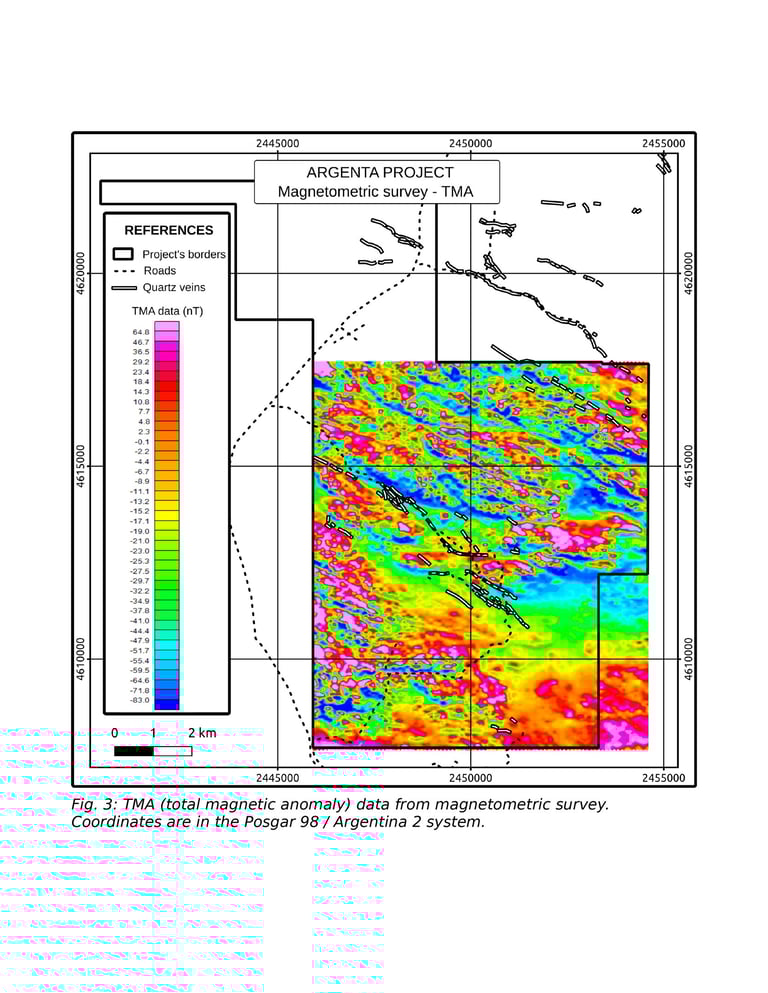
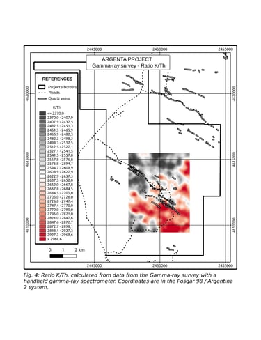
In 2023, Fomicruz carried out additional exploration in the project, collecting abundant data, part of which are still being interpreted. That work included (a) general lithological mapping (Fig. 2); (b) recognizance of areas that had not been previously visited, discovering a few new veins; (c) detailed mapping of several veins; (d) ground-based magnetometric surveys, covering 8800 ha (Fig. 3); (e) collection of more geochemical rock samples from the veins, which add to the 494 total outcrop samples in the project; (f) collection of samples for being analyzed by a portable x-ray spectrometer and a reflectance spectrometer; (g) a gammaray survey with a handheld spectrometer that allows discrimination of K, Th and U.
Almost 3000 ha were surveyed with our gamma-ray spectrometer, mapping the contents of potassium and thorium, to test their ability to detect potassic alteration and the presence of adularia. In general, that survey (Fig. 4) showed spatial correlation of high potassium contents with the location of several veins, particularly with those where adularia was observed. From now on, the company has to fully evaluate all the data collected in the project to be able to determine the next steps to follow, which may include further drilling.